Chapter 5 Shiny apps to improve spatial comparison and visualization
For Demonstration purposes only. Under development.
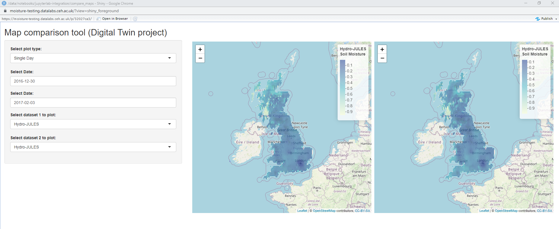
5.1 Map comparison tool
https://moisture-leaflet2min.datalabs.ceh.ac.uk/
Many environmental applications have a strong spatial component. The ability to compare maps becomes very helpful. This app provides a lightweight way to compare any two raster layers based on user inputs. The two interactive maps (powered by leaflet) are zoomable and synchronized.
5.2 PBMS demo app
https://statetag-pbmsdemo.datalabs.ceh.ac.uk/
Predatory Bird Monitoring Scheme is a citizen science project which members of the public submit the carcusses of birds of prey found for a biosy. The 20+ years worth of data is held in a database and has not been shared publicly. This app provides an easy way to visualize individual bird submission and provide data analytics, which is a great way to engage with various stakeholders.